 Getting on with my life and thinking about things.


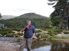


I love maps. Maps hold information, and information is power. When in the outdoors, it can be the power of life and death. Or simply finding a decent, comfortable wild camp hours before arriving in the area. It is almost magical.
The new iPhone also worked its magic on me when I was off ill. I found out about the launch accidentally when looking at my O2 phone bill. It launches on the 11th of July this year. Shiny. By the time I had finished watching the keynote speech, I was hooked. Heck, Jobs had be hooked about 25% in. (link)
The big draw? Assisted GPS (dfn). This will allow so many new applications to be developed as to be unimaginable.
For me, I want to be able to link a live trail-log to blog posts. In English: I post a blog entry from the trail, and the system updates a map with a flag to allow users to click and read the blog post. An old-school version of something similar exists on this blog: My Munros map. It is clunky and requires 2 apps to get it updated. Not very WebGeo.
So, what I want to be able to do is:
1. Write post in a decent editor. Add photos to it. Be able to send post direct to my blog.
2. I want to be able to add my current location from the GPS system to the post and have this used by the software (i.e. I don't want to have to type in long old-school lat/long numbers).
3. I want that data to be added to a map on my blog (I'll accept some initialisation if required).
The details of the map (probably Google Maps), won't be as good as the Ordnance Survey, but it will be good enough to allow people to read that I'm okay/moaning/singing/sleeping in/changing plans (delete as applicable) and see where abouts on the trail that I am.
Of course, for this to work out in the real world (i.e. not within the proportion of the country that the telephone companies can be bothered to give cellular access to). I think that OffConn needs to step in - but they'd have to climb out of the pockets of the companies and start standing up for the citizens that pay their wages.
--
Some GeoBlogging links (old-school definition on Wikipedia)
- Google Geo Developers Blog
- Lat Long Blog (official Google Earth & Maps blog)
- Google Maps Mania (unofficial)
- Where2.0 Conference
- Adam Burt's 2006 post: Overview of Geo-Blogging
- Geobloggers.com
- How to insert a map in your blog
- Geoblogging using Google AJAX API
- Rob O'Daniel's post: How to Geotag Your Blog
9 comments:
I love maps too - great post
I've got an old 1 inch to the mile map of Skye, printed on cloth. I'm always on the lookout for a decent frame for it so I can hang it on a wall. It's a work of art.
The first iPhone was pretty good. I shall be replacing mine with the new one. The phone software should take mobile computing to the next dimension.
But a map is a thing to prize :-)
I used to have the John Speed ones when I worked down south. Good to see the areas I was working in.
Here, the National Library of Scotland has lots of Pont's maps online. Lovely stuff.
How's about the Orbit 2 with Memory Map on board. It's by ...oh, err, O2. Seriously worth contemplating though.
Pablo.
Pablo's Woodlife
Sorry forgot the
review link
Pablo
Pablo's Woodlife
I think Darren has something similar with Anquet and his smartphone.
I love the future that Apple are offering a glimpse of. Other smmartphones are merely present, I think only the Blackberry has changed the way some people work/live.
I'm not going to jump out right off and buy the 3G iPhone with aGPS but I am intrigued by the possibilities (unless I come up with some nifty ideas I can develop software for; and I'll take suggestions from anyone - this would be a great reason to get back into software design--yes, I have an iPhone). One big issue for me will be the limitations on application development for the GPS. We already know that some exist, no turn-by-turn tools can be developed if I understand the SDK license agreement. I don't care so much about that for trekking but I certainly want to be able to put a route on screen and at least no direction and distance to the next waypoint on that route or anywhere else. And their will need to be the facility to plot on to web based and locally stored maps since, after all, you can't count on a net connection.
If, big if, battery life is halfway decent the iPhone could be a very nifty GPS device for short duration use. I'd not want to use it as a GPS tracker but if I could use it in short stints that display would really make life so much nicer.
Of course, commercially the uses of the GPS will probably be found in other places that the very small niche back country travelers make up and I really don't see my iPhone replacing a dedicated GPS any time soon given issues of battery life and, to a lesser extent, weatherproofness and general toughness (though my iPhone has taken a beating since I bought it).
I've been catching some to the "TWiT" podcasts and one of them has a gps dongle as it takes less battery life to bluetooth across than it will do (they speculate) to leave the gps on.
The restrictions may get annoying, but it seems a big step forward for Mac. I think the limitations will be of the Net access, or as they are annoyingly calling it now "The Cloud". But someone needs to extend the Net out beyond the limited 3G access. So, yes, mapping software that works offline.
But, being a belt n braces chap, integrating devices is okay for town use, but not when outdoors as one failed device means you're scuppered. Even if it is wrapped in an Otterbox, a recharger cable can break (as happened to me on the SUW) and the device runs out of charge.
And, yes, I always have a map and compass with me too.
Post a Comment